FIELD SITESThe project considers direct pilot application to two field sites representing different but complementary realities: the Bologna and the Cremona Aquifer system, located in Northern Italy, within the alluvial Po Plain. |
|
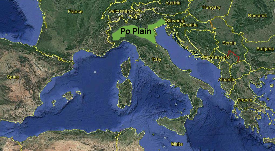
The Po Plain in Northern Italy |
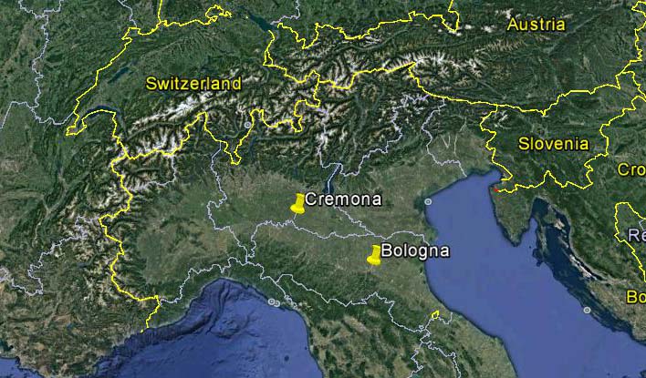
Location of the study areas within the alluvial Po Plain
|
CREMONA SITE
|
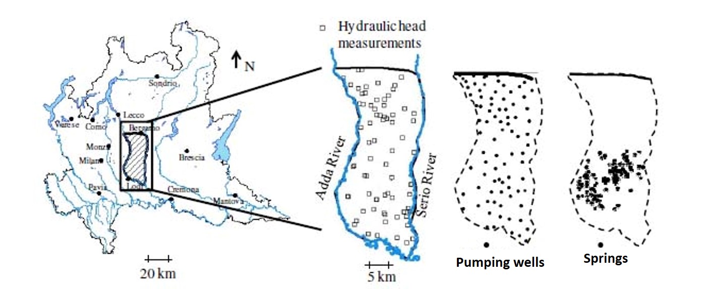
Study area and its location within the Lombardia region; location of piezometric head measurements, wells and springs |
The Cremona site lies within the Lombardia Region. The Western and Southern boundaries of the aquifer are formed by the Adda river, flowing from North to South until it joints the Po river. The Eastern boundary is the Serio river, flowing from North to South until it flows into the Adda river. The presence of several natural springs, occurring where the water table reaches the ground level elevation, constitutes a special hydrological feature of this area which is part of the so-called Springs Belt. Natural high-quality water springs are the main supply to agriculture and a key environmental driver.
|
|
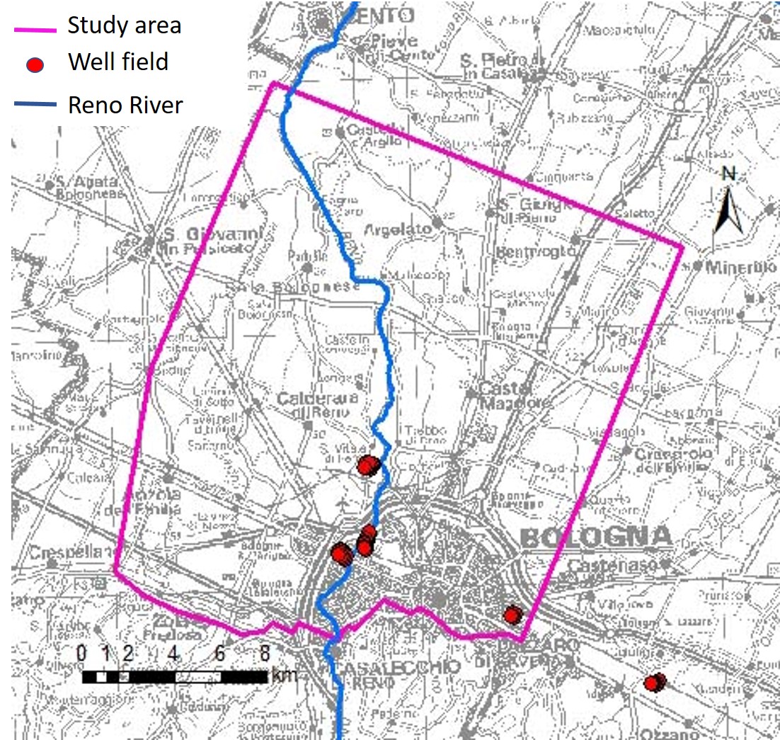
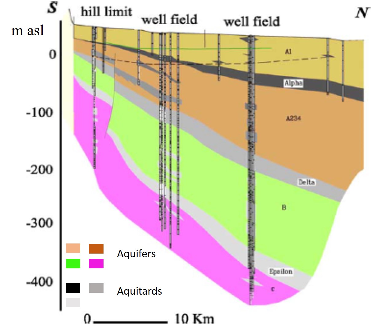
The geological architecture of the study area has been reconstructed on the basis of geological stratigraphic information provided by the Regione Lombardia, the Consortium Media Pianura Bergamasca (CMPB) and the Consortium Irrigazioni Cremonesi. Hydrochemical data are available at selected locations which are part of the monitoring network managed by the Regional Environmental Protection Agency (ARPA Lombardia). BOLOGNA SITEThe Bologna site is part of the high-medium alluvial plain close to the city of Bologna in the Regione Emilia Romagna, within the Reno alluvial fan. Some well fields are located within the study area. The alluvial deposits form large and productive aquifer systems. Three Plio-Pleistocene aged fresh water aquifers have been identified: Aquifer Group A (between 0 and 150-200 m), Aquifer Group B (between 150 and 300-350 m) and Aquifer Group C (more than 300-350 m deep). These correspond to Cycle A, B, and C respectively and are composed of alluvial and sea deposits, both coarse and fine. The coarse deposits are essentially related to the fluvial activity of the Appenine streams and of the Po River. Generally, these aquifers are separated by discontinuous horizons (aquitards) of variable thickness and lithology. The geological architecture of the study area has been reconstructed on the basis of geological stratigraphic information provided by the Geological, Seismic and Soil Survey of the Regione Emilia Romagna. Hydrochemical data are available at selected locations which are part of the monitoring network managed by the Regional Environmental Protection Agency (Arpae Emilia Romagna). |
|
Planar view of the Bologna site |
Cross-section of the aquifer system |